

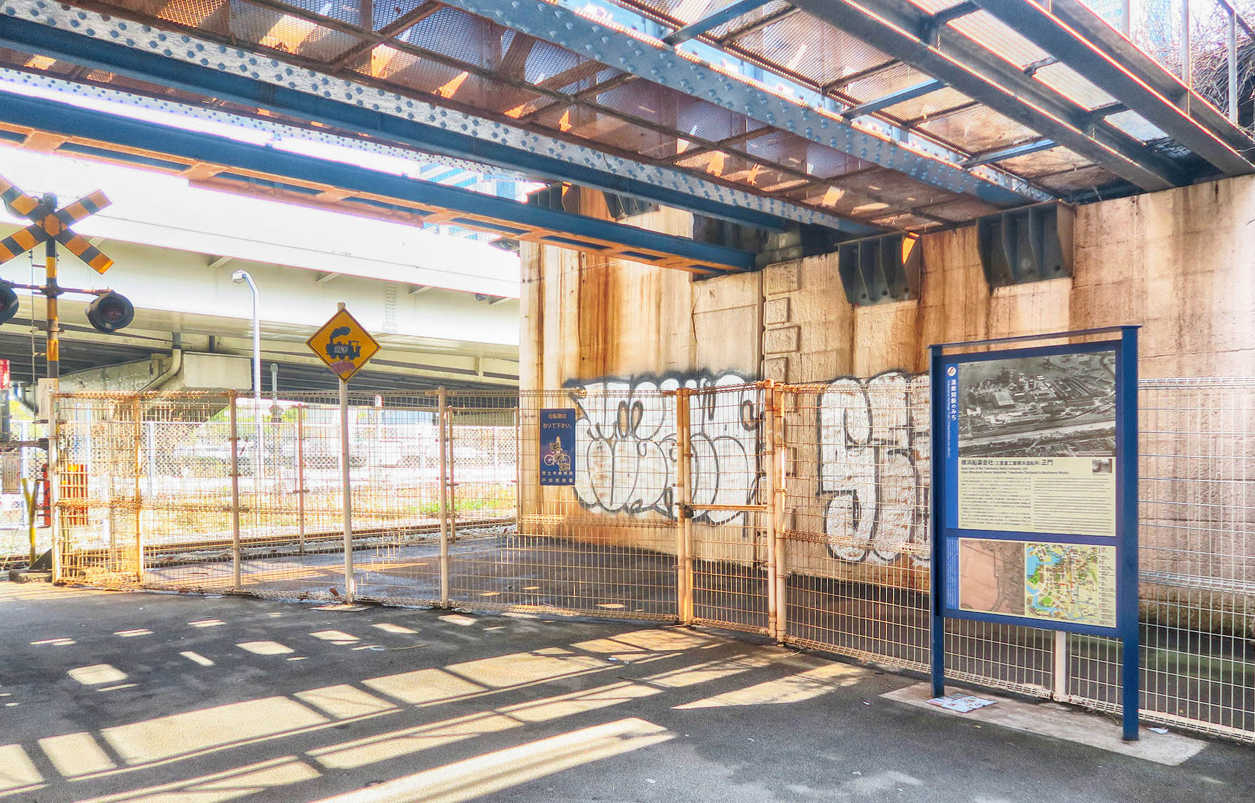
西区の埋立の変遷の案内板から線路を渡り、国道16号の手前に設置されている案内板です。
横浜船渠会社は、1935年に三菱重工業と合併して、三菱重工業横浜船渠になりました。
その後も名称はいくどか変わりましたが、三菱重工業横浜製作所となり、本牧工場と金沢工場(現在は閉鎖)が出来ました。
ドライドック2基は敷地内に残され、国の重要文化財に指定されています。
横浜船渠会社(三菱重工業横浜造船所)正門

かつてこの付近には「ハマのドック」の名で親しまれた横浜船渠(せんきょ)会社(後の三菱重工業横浜造船所)の正門があり、数多くの人がこの場所を行き来しました。
貨新線の「みつびしどっく踏切」という踏切名称にその名残を見ることができます。
みなとみらい21地区には横浜船渠会社の遺構として、日本丸メモリアルパーク(第一号ドック)、ドックヤードガーデン(第二号ドック)などが残されています。
現在JR根岸線が走る上部の高架は、大正7(1918)年に二代目横浜駅(大正4(1915)年に現高島町駅付近に建設)と桜木町駅(初代横浜駅)の間に建設されました。
昭和7(1932)年には高架を海側に増築し、空いた山側の単線は東京横浜電鉄線(東横線の前身)になりました。昭和31(1956)年には、歩道の上に高架を張り出して東京横浜電鉄線が複線化し、現在の高架の形になりました。
高架に沿って走る道路は国道16号です。ここには昭和45(1970)年まで市電が走っており、近くには電停の花咲橋や雪見橋がありました。
国道を渡って行くと、戦災復興期に埋め立てられた運河である桜川(現在、桜川新道)、そして横浜船渠会社で働いた多くの人たちが利用した商店街、料亭街として賑わった歴史のある岩亀横丁へとたどり着きます。
Main Gate of the Yokohama Dock Company, Ltd.
(later Mitsubishi Heavy Industries’ Yokohama Dockyard & Machinery Works)
This was the location of the main gate of the Yokohama Dock Company, Ltd. (later Mitsubishi Heavy Industries’ Yokohama Dockyard & Machinery Works) – the company fondly referred to by its nickname ‘Hama-no-Dock.’ A freight line crossing in the area, called Mitsubishi Dock Fumikiri (Mitsubishi Dock Crossing), serves as a reminder of those times. In the Minato Mirai 21 District, other reminders of the company include the Nippon Maru Memorial Park (No. 1 Dock) and Dockyard Garden (No. 2 Dock).
An elevated railway was constructed in 1918 between the second Yokohama Station (built in 1915 near the current Takashimacho Station) and Sakuragicho Station (the first Yokohama Station), a segment now served by the JR Negishi Line. In 1932, the elevated structure was widened in the seaside direction, and the track on the inland side became the single-track Tokyo Yokohama Railway Line (predecessor of the Tokyu Toyoko Line). In 1956, the elevated structure was further widened inland, out over the sidewalk, and the Tokyo Yokohama Railway Line, became double-track, which is the current elevated configuration.
The road along the elevated railway (between Takashimacho and Sakuragicho Stations) is National Route 16. Streetcars ran along this road until 1970, with stops at Hanasakibashi and Yukimibashi. Across Route 16 was Sakuragawa River (currently Sakuragawa Shindo (Sakuragawa River New Road)), a canal that was filled in during the postwar reconstruction period. In the same direction was Ganki Yokocho (Ganki Alley), which prospered as workers at the Yokohama Dock Company, Ltd. came to eat and shop.